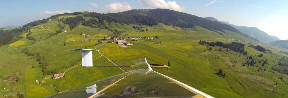
Following the demonstration of more than 12 hours of continuous flight endurance with AtlantikSolar AS-1 in summer, the AtlantikSolar prototype (AS-P) has performed a continuous 6-hour aerial mapping flight with a full mapping payload in winter conditions on AS-P Test Flight #22 (November 21st). Judging from the remaining battery capacity, the actual endurance of the airplane with payload is significantly higher than six hours even with the full mapping payload, which demonstrates the long-endurance capability of the airplane under challenging conditions (winter, full payload of 0.7kg mass and 15W power consumption). Figure 1 below shows AtlantikSolar in this mapping configuration.
The flight was performed in Rothenthurm (CH) and is the most recent of various aerial mapping flights performed this summer. The aircraft’s sensor pod was equipped with an infrared camera that is employed within the EU research projects ICARUS and SHERPA to perform aerial victim detection e.g. in alpine rescue scenarios. An exemplary infrared camera image from the airplane with simulated victims is shown below (figure 2). In addition, the aircraft carried an optical camera to perform detailed aerial mapping of an area of 1km² (the equivalent of 20 soccer fields) in less than 20 minutes, so the overall mission time would have allowed the mapping of more than 20km². An exemplary view of a 2-D and 3-D map recorded by AtlantikSolar during the ICARUS field trials in Marche-en-Famenne, Belgium, is given in figure 3 and figure 4 below. ICARUS and SHERPA foresee that the reconstructed 3-D maps from the UAV are used to help ground-based first response teams to better plan their rescuing missions.
We’ve recorded numerous data sets – also in collaboration with many other air- and ground-based robots – this summer. Have a look at our data set page, which summarizes a data set that was recorded for ICARUS.

Figure 1: AtlantikSolar UAS in its mapping configuration – i.e. with a wing-mounted sensor pod comprising optical and infrared cameras as well as a processing unit

Figure 2: Infrared-camera view from AtlantikSolar – the potential victims (humans) can be seen in the lower left side of the image

Figure 3: Reconstructed 2-D map of Marche-En-Famenne, Belgium

Figure 4: Reconstructed 3-D map of Marche-En-Famenne, Belgium