One of the prime applications that we are targeting with our solar-powered UAVs is to provide aerial support in large-scale disasters. From October 21st – 31st, in the Aventura AtlantikSolar@Brazil project, we had the chance to directly support our Brazilian partners through the first real-life (i.e. outside of research projects) disaster support mission with AtlantikSolar. Requested by SIPAM (Brazilian Amazon Protection System, part of the Brazilian Ministry of Defense), we were tasked to perform aerial sensing and mapping around the site of a disaster – a sunken ship that involved over 4400 dead cattle and 750t of oil spill – that had happened 2 weeks before.
After launching on the beach of Caripi, our solar-powered UAV was directed to fly the more than 10km down the river (Rio Para) towards the disaster site in port of Barcarena. The conditions of the Amazon rain forest proved to be a significant challenge for both the airplane (traveling through winds up to 10m/s) and the boat (struggling with waves up to 2m high) with the UAV operator and a safety pilot. The aerial imaging process could nevertheless be started as scheduled upon arrival at the disaster site, and the airplane captured high-resolution aerial images of the sunken ship and the surroundings including the expected oil spill affected area. In addition, during the whole flight atmospheric pressure, wind speeds, humidity, temperature, and solar radiation were recorded. All in all, a total of 70GB of data was provided to SIPAM for an improved coordination of relief efforts. In fact, the data and the high resolution optical camera on-board AtlantikSolar were used to create a 3-dimensional map that later helped Censipam determine the extent of environmental damage as well predict where the current in the river might deposit any additional oil slicks or bovine remains during salvage operations. After the aerial mapping mission, the airplane successfully flew back to the launch site navigating even heavier winds than it had endured on the first leg. However, upon arrival at Caripi beach, and only seconds before the scheduled landing a communication failure caused the aircraft to overshoot and touch down behind its planned landing spot. Due to the limited landing space on the beach, this resulted in a water landing and damage to the airplane, such that the test flight operations had to be halted. We regret this unfortunate technical setback, however, we think that operating in such challenging climatic (strong wind and waves) and geographic (above water) conditions and accepting the risks associated with them is vital and, in fact, the only way to test and improve the robustness of our Unmanned Aerial Vehicles like AtlantikSolar for future disaster support and search-and-rescue missions.
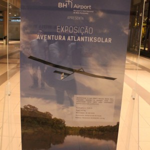
Apart from the technical relief missions, we had a great chance to work together with our Swiss-Brazilian partners – Swissnex and SIPAM primarily – to present and discuss about the benefits of renewable energies and solar-powered aircraft in general! This included two exhibtions on AtlantikSolar, various conferences and podium discussions with local researchers and the interested public, and interviews by Brazilian journalists. Many more impressions of the full Aventura AtlantikSolar@Brazil mission can be seen on our twitter account. A set of photos of the whole mission is shown below. We’ll update this page once the full with of press coverage is available, so stay tuned!
-
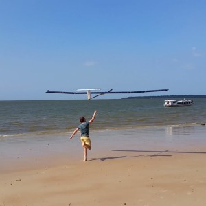
- The solar powered AtlantikSolar UAV is ready for launch at Caripi Beach.
-
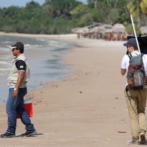
- Interviews before launch
-
- Launch
-
- Transitioning the UAV control station to the boat
-
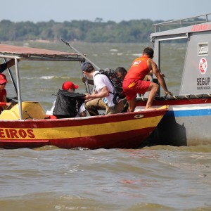
- Boats of the bombeiros (fire brigade) and the police participate.
-
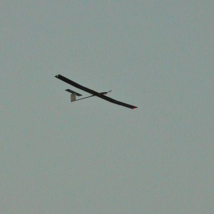
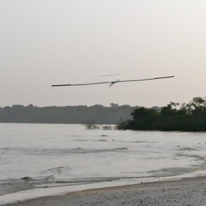
- In flight above Caripi Beach, State of Pará, Brazil.
-
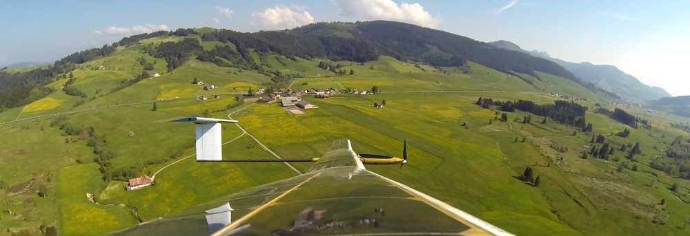
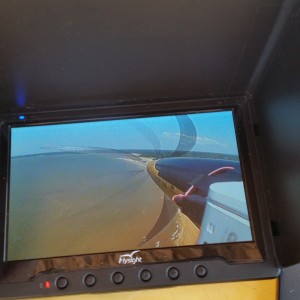
- AtlantikSolar above the Rio Para river in the Amazon rain forest
-
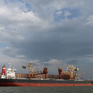
- Barcarena port, the location of the ship disaster
-
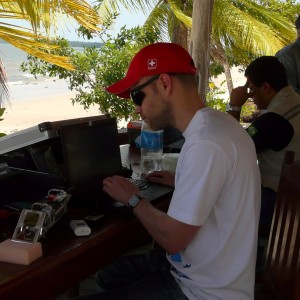
- Analysing the data after the flight
-
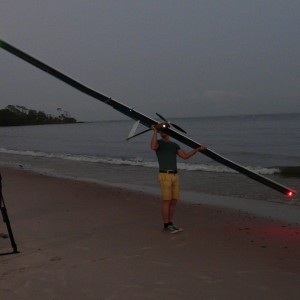
- Preparations for another flight before dawn.
-
- Landing after flight.
-
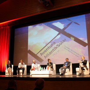
- Aventura AtlantikSolar@Brazil: Opening Ceremony
-
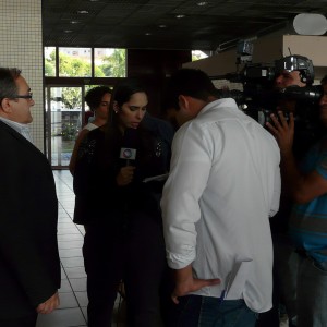
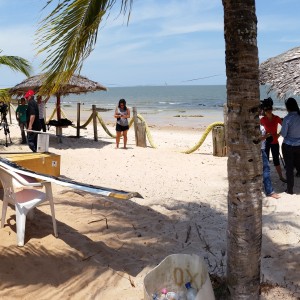
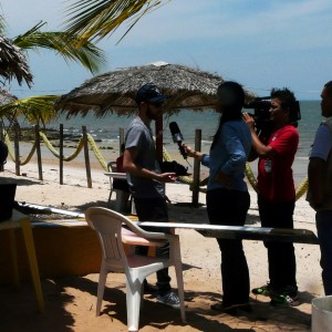
- Our project partner, Prof. Joao Pinho from the Federal University of the state of Para, being interviewed.
-
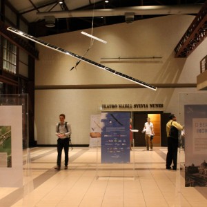
- Aventura AtlantikSolar@Brazil: Exposition
-
- Aventura AtlantikSolar@Brazil: Exposition
-
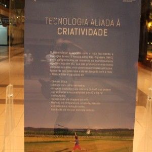
- Aventura AtlantikSolar@Brazil: Exposition
-
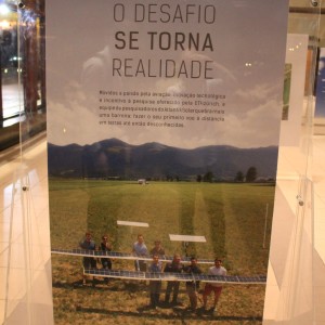
- Aventura AtlantikSolar@Brazil: Exposition
-
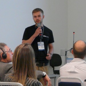
- At the Drone.Show Latin America